Topic: Flood Risk
Published: 14 Sep 2026
Building in a Houston floodplain: the 50% rule, and what the post-Harvey maps changed
If any part of a Houston house sits in a mapped floodplain, its lowest floor has to be built above the flood elevation the local jurisdiction sets, and a remodel costing 50% or more of the building's market value is treated as new construction and must meet the same rule. Inner-loop, where the land is worth more than the house, that 50% line arrives far sooner than owners expect.
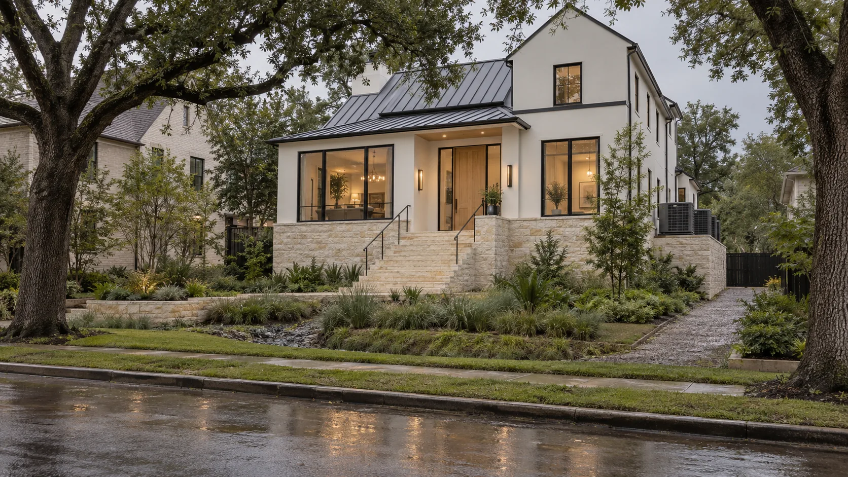
If your Houston lot is in a mapped floodplain, the lowest floor of any new house has to sit above the flood elevation your jurisdiction sets for that spot, and the same rule reaches back into remodels. Under the federal flood insurance program's minimum standard, work that costs 50% or more of the building's market value counts as a "substantial improvement," and the whole house then has to be brought up to the rules for new construction. That second part is the one that ends renovation plans, because inner-loop the building is often a small share of what the property is worth.
Check the map before anyone draws anything. Before you buy, if you still can.
What did Harvey change about the flood maps?
Mostly, it changed who is in them.
Hurricane Harvey in August 2017 put water into a great many Houston houses that sat outside the mapped 100-year floodplain, and the maps across Harris County have been substantially revised since. Properties that were never inside a mapped floodplain are inside one now. Owners who bought in 2015 with no flood insurance and no reason to think about it can find they are on the wrong side of a line that moved after they closed.
The City of Houston also tightened its own floodplain rules after Harvey, and that is a separate change from the maps. The map tells you whether the rules apply to your lot. The ordinance tells you how high you have to build.
And the ordinance depends on who issues your permit. The city writes one set of rules. Harris County writes its own for unincorporated land, and Bellaire, West University Place, Pearland and Sugar Land each administer theirs. Two lots a few miles apart, both in the same flood zone, can carry different elevation requirements because they sit in different jurisdictions, which is the whole argument of four Houston addresses, four permit processes.
Get the current standard in writing from the office that will issue your permit. It has changed before. I would not trust anyone's memory of the number, mine included.
What do the flood zone labels actually mean?
The labels come from FEMA and mean the same thing everywhere in the country:
- Zone AE is the 1% annual chance floodplain, the one everyone calls the 100-year floodplain. The map prints a base flood elevation for it, the height water is expected to reach in that flood.
- Shaded Zone X is the 0.2% annual chance floodplain, the 500-year.
- Unshaded Zone X is outside both. That does not mean no risk. It means not mapped.
- The floodway is the channel of a bayou or creek plus the land right beside it that has to stay open for water to move. Building a house there is close to off the table.
"100-year" is the worst name in residential real estate. It means a 1% chance in any single year, and the years add up. Over a 30-year mortgage, a house sitting right on the 1% line has roughly a 26% chance of seeing that flood at least once. Buyers hear "100-year" and file it next to things that happen to other people. A 1-in-4 chance over the life of the loan is not that.
How high does the house have to sit?
That depends on 3 figures, and only one of them is on the FEMA map.
The first is the base flood elevation at your lot. The second is freeboard, the extra height a local jurisdiction requires above the base flood elevation as a margin, and post-Harvey rules in this region lean on it. The third is your existing ground, which only a survey can tell you. The distance from that ground up to base flood elevation plus freeboard is how far the finished floor has to rise.
A surveyor records it on an Elevation Certificate, a standard FEMA form. Order one with the boundary survey, before design starts. It sets the height of every section drawing in the set, and a design drawn on an assumed floor height gets redrawn when the real number arrives. You will need a second, final certificate once the house is built, and your flood insurance is rated from it.
What does raising the floor do to the design?
More than people budget for, and not only in the foundation.
The foundation type. On a slab house the pad gets built up. Many floodplain rules restrict fill, because dirt that raises your lot pushes water onto your neighbor's, so a raised slab often ends up on stem walls or piers rather than on a mound. Pier-and-beam, common in the pre-1950s inner-loop stock, takes elevation more naturally because the house is already off the ground. Either way the piers or beams go down into gumbo clay, and what that clay does to a foundation does not stop mattering because the floor went up.
Everything mechanical. The flood program expects building utilities to sit at or above the flood elevation too. That means air-conditioning condensers on raised platforms, the electrical panel and the water heater above the line, and no ductwork running through a crawlspace below it.
The front door. Every foot of elevation is steps. For owners planning to stay into old age, a ramp at the usual 1:12 slope needs 12 feet of run for every foot of rise, so a floor raised 3 feet wants 36 feet of ramp before landings. That is a site plan problem, not a railing detail, and it is far easier to design in at the start. The same goes for the garage, which often stays at grade while the house goes up, leaving a stair inside the house that nobody asked for.
The height limit. Several Houston-area cities cap building height, and some measure it from natural grade. Raising the floor spends part of that allowance before the second story starts. Deed restrictions can carry height caps of their own, measured their own way. On a narrow inner-loop lot you can lose the ceiling height you wanted upstairs to a floodplain rule that never mentions ceilings.
The street. In a City of Houston historic district, a house raised well above its neighbors has to get through Certificate of Appropriateness review, which looks hard at how a house sits relative to the rest of the block. Floodplain elevation and historic review can pull in opposite directions on the same lot. That gets resolved in design, early, or it gets resolved at the counter, late.
What is the 50% rule, and why does it hit harder inner-loop?
Here is the rule, at the federal minimum. If the cost of improving a building in a mapped floodplain equals or exceeds 50% of the building's market value before the work, it is a substantial improvement, and the whole building has to be brought into compliance with current floodplain requirements. In practice that means elevating it. The same test applies after a flood under the name substantial damage: if repairs cost 50% or more of the building's pre-flood value, it is rebuilt to the current standard, not to what was there.
The words that matter are "of the building." Land is excluded.
That is the Houston problem. Inner-loop, the lot is frequently worth more than the house standing on it, which is what drives the teardown market in the first place. Take a hypothetical property worth $900,000, where the house itself is valued at $250,000 and the rest is dirt. The 50% line on that house is $125,000 of work. A new kitchen, 2 bathrooms and a roof is not an exotic scope, and it can get there.
The usual sequence goes like this. The owner designs a renovation, prices it, and submits. Somewhere in review the construction cost is compared to the building value, the number crosses 50%, and a remodel becomes an elevation project. The choices at that point are all bad: cut the scope below the line, pay to lift the house, or step back and run the numbers on remodeling versus tearing down and rebuilding, because once you are elevating anyway, new construction starts to look different.
Jurisdictions apply the rule their own way above the federal floor. They differ on which market value they accept, what costs count, and whether they add up improvements across several years so a project cannot be split into phases to stay under the line. Ask the floodplain administrator (every community in the flood insurance program has one) how they calculate it before the design is priced, not after.
A word on the obvious workaround. Some owners are tempted to put a low construction number on the permit. The floodplain administrator can ask for the contract, the flood insurance rating follows the building, and a buyer's lender will eventually look at the file. It is not worth it.
Can a lot be taken out of the floodplain?
Sometimes, and it is worth asking before assuming the worst.
Flood maps are drawn at a scale that cannot see every lot. If a survey shows the natural ground where the house sits is already above the base flood elevation, FEMA can issue a Letter of Map Amendment, which formally removes the structure from the mapped floodplain. That changes the lender's insurance requirement and the rating. Your surveyor can tell you from the Elevation Certificate whether the lot is a candidate.
Here is the concession. A Letter of Map Amendment changes a line on a map. It does not change where water goes when it rains.
Is a house outside the floodplain safe from flooding?
No. Harvey settled that argument.
Plenty of the houses that took water in 2017 were outside every mapped zone. Heavy rain in Houston runs down the street before it reaches a ditch or a bayou, and a lot can flood from the street or from a neighbor's yard without a bayou coming anywhere near it. The maps model a river flood. They do not model a clogged inlet on your block.
So even with no rule requiring it, I would set a new house's finished floor comfortably above the crown of the street, grade the lot to shed water away from the foundation, and treat any detention your jurisdiction requires as a real system rather than a box to check. Flood insurance outside the mapped zones is usually far cheaper than inside them. Price it anyway.
The other side of that deserves saying too. Elevation has real costs beyond the foundation: steps at every door, a house that sits taller than the ones beside it, a harder path to aging in place. Owners who build exactly to the minimum and no higher are making a defensible trade, not a careless one. The minimum is the only part that is not optional.
What should you check before buying or designing?
In roughly this order:
- Look the lot up on FEMA's Flood Map Service Center and on the county's current flood maps. Not the listing, and not a neighbor's recollection.
- Ask the seller for any existing Elevation Certificate and the property's flood history, including insurance claims.
- Order the boundary survey with elevations and an Elevation Certificate before design.
- Call the floodplain administrator for the jurisdiction that will issue the permit and get the elevation standard in writing.
- For a remodel, find out how that office values the building, then work out the 50% line before anyone draws a plan.
None of that takes long, and every item is cheaper than finding out at plan review.
For the design side of the same problem, how the envelope, roof, power and water hold up when the storm arrives, Modern Acre Studio's guide to designing a Houston house for hurricanes and high water picks up where the permit rules stop.
The register sorts residential practices by the jurisdiction they file in, which turns out to be the first question here as well. The cost calculator will not price elevation for you, but it will show the design and construction lines you are adding it to.