Topic: Land
Published: 2 Nov 2026
The survey from your closing is not the survey your architect needs: what to order for a Houston lot
The survey you got at closing shows where the corners are. It does not show how high the ground is, where the sewer sits or how big the oak is, and a Houston house design depends on all 3. Here is what to order, in what order, and what to ask the surveyor to put on the drawing.
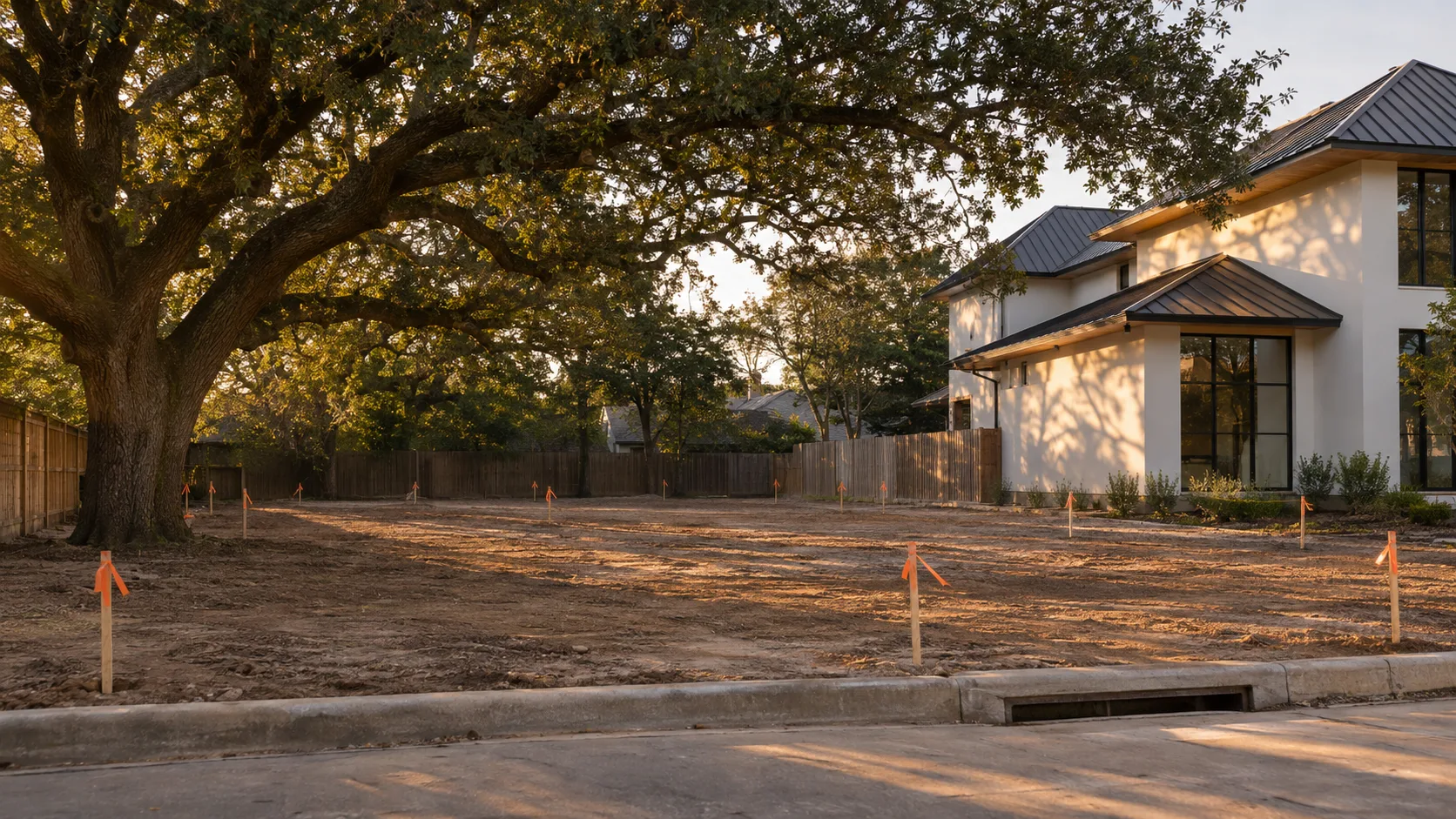
The survey in your closing folder shows where the lot corners are and what stood on the lot on the day it was drawn. It almost never shows how high the ground is, how deep the sewer runs, or how wide the oak canopy spreads. A Houston house design needs all 3, and drawing without them means drawing on guesses that get redrawn later.
I see the same sequence every few months. A client buys a lot, hands over the closing survey, and asks for a floor plan. The plan comes back in 3 weeks. Then the real survey arrives, the finished floor has to rise 14 inches, the sewer connection is shallower than the plumbing layout assumed, and the oak that was drawn as a tidy circle turns out to have a root zone that eats a corner of the garage. Half the plan gets redrawn. Nobody made a mistake except the order of operations.
What the closing survey is, and why it is the wrong tool
A closing survey, usually called a mortgage or title survey, exists to satisfy a title company and a lender. It confirms the legal description, shows the improvements that existed on the day of the field work, and flags obvious encroachments like a neighbor's fence across the line. That is a real job and it was done for a real reason.
It was not done to design a house. Three things make it a poor design base:
- It is a snapshot of the old property. If the lot has a 1960s ranch on it that you are tearing down, the survey carefully dimensions a building that will not exist.
- It may be years old. Surveys get reused between owners. A drawing from a previous sale does not show the addition the neighbor built last spring, a utility pole that moved, or a driveway apron the city rebuilt.
- It is flat. A boundary survey is a 2-dimensional drawing. It does not carry ground elevations, so it tells you how wide the lot is and nothing about how it drains.
A fence is also not a boundary. Houston lots are full of fences that sit a foot or 2 off the line, and a house designed to the fence inherits that error. The surveyor's pins and the recorded plat decide, not the fence, and not a neighbor's memory.
The 4 things a design survey needs to show
If you take one list from this article, take this one. Ask the surveyor to confirm, before field work, that the drawing will carry each of these.
1. Ground elevations on a grid, plus the street. Spot elevations across the lot, not a single number at one corner. Along the front, the top of curb, the flowline of the street gutter, and any storm inlet in front of or near the lot. These decide which way water leaves the property and how far the house must rise above the street. In Houston, where a heavy rain turns the street into the drainage system, the relationship between your slab and that curb is the whole game. The calculation behind it is laid out in how finished floor elevation gets calculated, and it starts from numbers only a survey can give.
2. Utilities, with depths where possible. The sanitary sewer cleanout or manhole nearest the lot, with its invert, meaning the elevation of the pipe bottom. Water meter location. Gas meter. Overhead lines and poles, with their clearances to where the house will stand. The sewer invert tells you whether the house drains by gravity at the slab height you want. If it does not, you are looking at a lift station or a higher slab, and you want to learn that in week 1.
3. Trees, with trunk diameters and canopy edges. Every tree over a size threshold your jurisdiction cares about, plus the neighbor's trees that overhang the line. Ask for diameter measured at a stated height, species where the surveyor can identify it, and the drip line drawn as an actual outline. A live oak near the foundation is a structural and legal question before it is a design question, and it can only be answered when the tree is on the drawing at true scale.
4. Easements and building lines, drawn, not just listed. The plat shows platted easements and building lines. The title commitment lists recorded easements that may not appear on the plat at all. A good surveyor plots both, labels each with its recording reference, and marks where they overlap. A utility easement running down the rear 10 feet is a boundary for the house, even though no fence marks it. The wider question of which rulebook applies to which address is in which jurisdiction governs your lot.
Houston's quiet trap: which datum are the elevations on?
Elevations mean nothing without a reference. The surveyor ties your numbers to a benchmark, and the benchmark sits on a stated vertical datum, usually NAVD 88, with an adjustment year attached.
Here is why that matters in this region. Parts of the Houston area sank for decades as groundwater was pumped, and the published elevation of a benchmark depends on when it was last resurveyed. Flood maps, county drainage studies, and a city's own datum may be tied to different adjustments, and the gap between them is not uniform across the metro. In some places it is small. In others it is large enough to move a floor by a visible amount.
So the instruction to the surveyor is plain: state the datum, state the adjustment, name the benchmark, and say whether the flood map elevation for the lot uses the same one. Then the architect can compare like with like. If your lot is in the mapped floodplain, this is the same thread as the Elevation Certificate described in building in a Houston floodplain, and it is cheaper to order the two surveys together than to send a crew back out.
The order to do things in
Buyers often ask whether to survey before or after hiring an architect. Before, if you can. But the sequence has a few moving parts, so here it is.
- Get the title commitment and the recorded plat. The surveyor needs both to plot easements correctly. Ask your title company for the commitment with copies of the easement documents.
- Order the boundary survey and the topographic survey as one job. A single crew, a single visit. Ask for them on the same drawing, plus a separate sheet if you want a clean boundary-only copy for the permit counter.
- Add the tree survey to the same visit if there is anything over about 6 inches in diameter on or near the lot. A second trip costs more than a longer first one.
- Add the Elevation Certificate if the lot touches a mapped floodplain, or if the lender or the jurisdiction asks for one.
- Hand the finished drawing to the architect before anyone draws a plan, and ask for it to be dimensioned from the surveyor's CAD file rather than from a PDF someone traced.
Lead time varies with the season and with how busy local firms are, and cost varies with lot size, tree count and terrain. Ask for a written quote and a delivery date before you commit, and expect the date to move if it rains during field work.
When the closing survey is enough
I do not want to overstate this. There are lots where the closing survey is fine as a starting point.
A flat lot in a recent subdivision, graded by the developer, with a fresh survey from the last 12 months, no mature trees, and a builder who is working to the plat's building lines. In that case, a quick boundary update plus a handful of spot shots may do. Production builders do this constantly, because their lots are uniform.
A custom house on an inner-loop lot is the opposite. A 1940s lot in the Heights, Bellaire or West University Place has slopes the eye cannot see, 80-year-old trees, utilities that predate the current plat, and neighbors close enough that a 6-inch error matters. For those, the full design survey is not a luxury. Skipping it is how a teardown budget grows by a change order that nobody planned for.
There is also a fair complaint against this advice: surveyors vary, and a topographic survey does not guarantee the drawing is right. Pins get disturbed. CAD files get edited. If a number looks off, ask the surveyor to re-shoot it; they would rather check than defend a bad point.
What goes wrong when the survey is thin
The recurring failures, in the order I tend to meet them:
- The slab height changes after the plan is drawn. The finished floor rises, stairs get an extra riser, a porch step becomes 2, and the street elevation of the house changes. All of it is avoidable.
- The plumbing plan is wrong. The sewer invert is higher than assumed, so the lowest fixtures cannot drain by gravity at the planned slab height.
- The garage conflicts with the tree. A root zone that the survey never drew gets discovered when the arborist walks the lot in month 2.
- An easement clips the footprint. Usually a few feet at a corner, always found late, and sometimes only after the permit set is stamped.
- Drainage fights the neighbor. Without ground shots across the line, no one knows that the lot actually sheds water onto the neighboring lot, or that the neighbor's regrade now sheds onto yours. The drainage side of that problem is in grading and drainage on Houston clay lots.
Questions people ask about surveying a Houston lot
Can I reuse the survey from the seller or my closing?
Treat it as background, not as a design base. Ask a surveyor to review it and update it. If it is recent and the lot has not changed, the update can be short. If it is old, the surveyor will tell you it needs a fresh field visit, and they will be right.
What is the difference between a boundary survey and a topographic survey?
A boundary survey establishes the lot lines, corners, easements and improvements. A topographic survey adds ground elevations, contours, utilities, and trees. For a custom house you want both on the same drawing.
Does the surveyor need to be licensed?
Yes. In Texas, land surveying is regulated, and the person who signs and seals the survey should be a Registered Professional Land Surveyor. Ask for the name and registration number on the drawing, and confirm it is current with the state board.
Should the survey come before the soil report?
Usually the same month. The survey tells the geotechnical firm where the house is likely to sit, which helps place the borings. The result then feeds the foundation design. How to read the soil report is in the geotechnical report guide.
Does the survey cover the lot's flood risk?
Not by itself. A survey shows elevations, which is half of a flood determination. The other half is the flood map and the base flood elevation, which come from FEMA and the local floodplain administrator. Together they tell you how high the house has to sit.
What if the survey and the plat disagree?
It happens more than owners expect, because plats are old and monuments move. Don't start design until it is resolved. The sister guide on what to do when the survey and the plat disagree walks through the usual causes and who fixes each.
Where this fits in the project
Think of the survey as the first drawing in the drawing set, even though the architect does not draw it. Every site plan, section and grading sheet is built on top of it, and an error in it travels through all of them.
If you are still deciding between remodeling and rebuilding, the same survey answers half of that question too: it shows whether the lot has room for the footprint you want once the easements, the trees and the building lines are subtracted. Order it before you price either path.